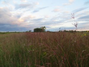
 Tall-grass Prairie MAPS station (near Tolstoi, Manitoba)
We run a MAPS (Monitoring Avian Productivity and Survivorship) program in the Tall Grass Prairie Preserve. It was started in 1996 and has been run almost continuously since then. The TGPP program has tracked the deterioration of this area over the years as it has been modified by natural succession and changes in drainage from a very good piece of tall grass prairie to its present condition of a shrubby marshland.
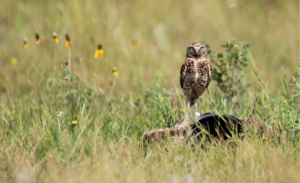 Burrowing Owl Recovery Project
We are involved with the reintroduce Burrowing Owls to southwest Manitoba near the areas of Broomhill, Medora, and Deloraine and collect data on breeding biology and foraging behaviours to help identify limiting factors that affect the Burrowing Owl.
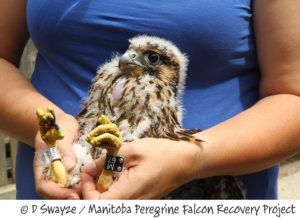 Peregrine Falcon Recovery Project – Southern Manitoba.
This project’s goal is to re-establish a self-sustaining wild population of Peregrine Falcons in Manitoba as part of the national peregrine recovery effort. We monitor wild peregrine populations, nest and roost sites in Manitoba, identify and monitor returning peregrines and band all chicks produced for future identification, work to establish new nesting territories in suitable locations across southern Manitoba and rescue and re-release orphaned and injured falcons and other raptor species.
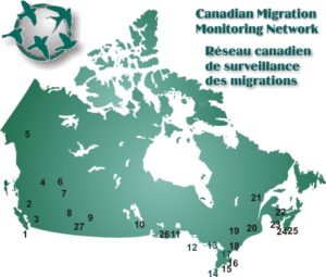 CMMN
CMMN
We are one of 26 migration monitoring stations across Canada. The Canadian Migration Monitoring Network (CMMN) consists of a network of independent bird migration monitoring and research stations operated by volunteers and/or paid staff. It is a collaborative initiative among these member stations, Birds Canada and Environment Canada’s Canadian Wildlife Service (CWS).
 MOTUS
MOTUS
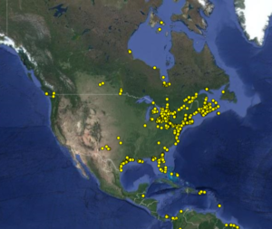
The MOTUS Wildlife Tracking System (www.motus.org) is an international, collaborative, automated telemetry array managed by Bird Studies Canada. This system uses stationary receiver stations spread across the landscape to detect uniquely coded radio-signals from nano-tracking tags attached to mobile wildlife. The system is ideal for tracking small wildlife that could not be tracked with previous technology. MOTUS is being used enthusiastically by those studying small landbirds, bats, and even large insects like dragonflies. Nanotags (<1g) emit a radio signal (usually every 10 s) that is uniquely coded to the individual carrying the tag. When an animal is within 12-20 km of a receiver, that signal is detected, logged, and the data sent to Bird Studies Canada where it is collated and sent to the researcher. Therefore, a receiver can log data from local projects, or pick up a signal from an animal that has been tagged anywhere if it journeys within the range of a receiver. The system is ideal for tracking local movements, presence/absence, migration departure dates, and movement between towers during migration.
The new receiver at Oak Hammock Marsh is one of six being installed in southern Manitoba by Kevin Fraser and his students from the Avian Behaviour and Conservation Laboratory at the University of Manitoba. These receivers build importantly on the current motus array, as there were no other receivers in southern MB until now, and only one other at Churchill. A map at www.motus.org shows the current distribution of receivers that includes the one at Oak Hammock Marsh.